
Pune: India is set to strengthen dam safety, flood forecasting, and river pollution monitoring through the ISRO-CWPRS Partnership, under which satellite imagery, drones, and artificial intelligence (AI) will be used to establish an advanced water resource management system.
The initiative follows a Memorandum of Understanding (MoU) signed between the Central Water and Power Research Station (CWPRS) in Pune and the Indian Space Research Organisation (ISRO-CWPRS Partnership)
The agreement, facilitated under the initiative of the Ministry of Jal Shakti, aims to create a modern framework for monitoring the country’s dams and rivers using space-based technologies.
According to A. A. Purohit, In-charge Director of CWPRS, the new system will accelerate safety assessments of thousands of dams, enable early flood forecasting, evaluate the structural health of dams, and identify pollution sources in rivers.
Speaking with mediapersons, the official said, “There are currently more than 6,000 dams in the country, of which nearly 2,500 are located in Maharashtra. Under the National Dam Safety Act, comprehensive safety assessments of all dams are mandatory. However, conducting physical inspections of every dam is both time-consuming and expensive.
Therefore, advanced technologies will now be employed. Satellite imagery provided by ISRO will help study structural changes in dams over time.
It will be possible to determine whether cracks have developed in dam walls, whether water pressure has caused structural deformation, whether there are signs of leakage, or whether the risk of landslides around dam sites has increased.”
Also Read: InCorp Advisory Provides Cross-Border Advisory to Support NASA–ISRO NISAR Satellite Mission
The ISRO-CWPRS Partnership will also integrate drone-based inspections with artificial intelligence and machine learning for detailed analysis of critical infrastructure.
Drones will be used to closely examine dam walls, gates, and other important components, while AI-driven systems will process the collected data to identify potential risks.
He further said, “The National Dam Safety Authority has selected CWPRS as the principal coordinating agency for this initiative. In the future, Pune is expected to emerge as an important national centre for dam safety.”
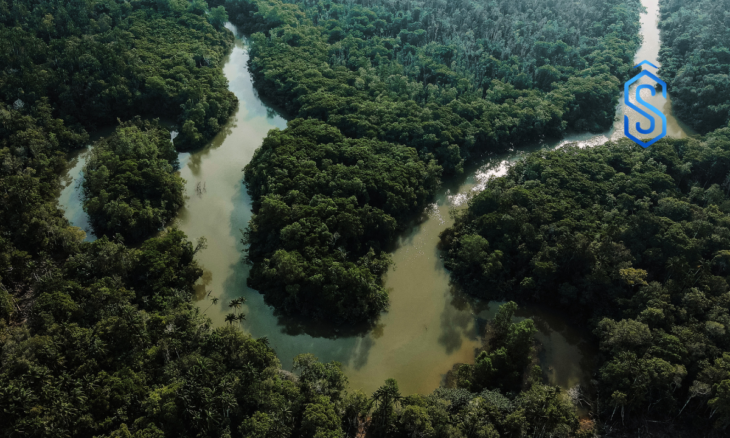
River Pollution Sources to be Identified from Space
Speaking with mediapersons, CWPRS Additional Director Dr. Selva Balan said the new technology would make it possible to monitor river pollution directly from space.
He said, “A specialized computer system is being developed using satellite imagery and Earth observation data. This system will help identify pollution intensity, probable pollution sources, and changes in water quality.
As a result, it will become possible to determine the exact origins of pollution in rivers such as the Ganga, Godavari, and Krishna, enabling authorities to exercise more effective control over polluting activities.”
Also Read: Satellites Reveal Uttarakhand Vegetation Decline Over Two Decades: ARIES Study
The ISRO-CWPRS Partnership is also expected to significantly improve flood prediction capabilities.
By analysing historical rainfall records, river flow patterns, satellite data, and field observations, authorities will be able to forecast flood situations more accurately.
Dr. Balan added that the technology would also support advance planning for potential dam-related disasters. If a dam faces structural risks or the possibility of failure, authorities would be able to estimate the geographical impact, identify affected villages, and prepare emergency response measures in advance. This would strengthen disaster management and improve preparedness for emergencies.