
Chennai: How can an autonomous ship identify nearby vessels, estimate their distance and make navigation decisions safely in changing weather conditions?
Researchers associated with IIT Madras‘ SEANAV maritime simulation platform are addressing this challenge through a combination of computer vision, stereo cameras and LiDAR-based sensing.
A study published in the Journal of Offshore Mechanics and Arctic Engineering describes a custom dataset comprising 14,000 real ship images and a sensor-fusion framework that combines stereo cameras with LiDAR.
The researchers evaluated their ship detection model in a Unity-based simulation environment, reporting improvements in vessel detection and position estimation.
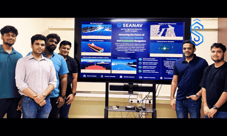
The research offers a closer look at the technology underpinning SEANAV, IIT Madras’ real-time digital twin platform designed to test autonomous navigation systems and train maritime professionals.
SEANAV Research Addresses Gaps in Maritime Training Data
One of the challenges in developing reliable autonomous navigation systems is ensuring that computer-vision models can identify ships under different environmental conditions and viewing angles.
The research paper identifies limited variation in viewing angles and weather conditions across existing maritime image datasets as a constraint affecting the reliability of deep-learning models beyond their training examples.
To address this limitation, the researchers developed DetectShips, a dataset containing 14,000 real ship images. They combined it with the existing SeaShips dataset to train a computer-vision model capable of ship detection and classification.
The use of real vessel images is an important component of the research, as it expands the visual material available for training maritime detection models.
However, the researchers distinguish between the training data and the testing environment. While DetectShips contains images of real ships, the evaluation described in the published abstract was conducted in a simulated maritime environment.
This approach allows the researchers to use real-world vessel imagery to train the detection model while evaluating its performance within a virtual maritime setting.
SEANAV Integrates Stereo Vision and LiDAR for Vessel Detection
Beyond ship detection, estimating the distance and position of nearby vessels is another important requirement for autonomous maritime navigation.
The study introduces StereoLiD, a hybrid sensing framework that combines stereo vision and LiDAR to improve vessel detection and position estimation.
The framework uses stereo cameras to detect and classify ships while estimating the distance of target vessels relative to the host ship. LiDAR data generated through the Unity platform is subsequently incorporated to improve depth estimation.
A Kalman filter combines measurements from the two sensing systems to improve estimates of vessel positions.
According to the researchers, this sensor-fusion approach is intended to address challenges associated with optical sensing, including changing lighting conditions and fog.
The study reports improvements in ship detection and position estimation. However, its accessible abstract does not specify numerical accuracy gains or distance-error measurements.
How IIT Madras’ SEANAV Platform Simulates Autonomous Ship Navigation
The research forms part of the broader technological direction represented by SEANAV, developed by the Department of Ocean Engineering at IIT Madras.
The Unity3D-based maritime simulator is designed to replicate ship navigation conditions and provide an environment for testing autonomous navigation technologies.
According to IIT Madras’ announcement, reported by NDTV and other news outlets, the simulator has been calibrated using a benchmark tanker approximately 320 metres long.
Rather than assuming ideal sensor inputs, the platform incorporates practical limitations such as sensor noise and delays to make the simulated navigation environment more representative of real-world conditions.
The SEANAV platform also integrates marine radar and a Meta Quest-based virtual reality interface. This allows users to experience simulated navigation from a ship’s bridge.
IIT Madras has reported demonstrations of autonomous path-following and AI-driven collision avoidance under simulated conditions.
These capabilities allow the platform to serve as an environment for testing autonomous navigation systems while providing maritime professionals with an immersive training experience.
Physical Validation Remains a Next Step for SEANAV
While the simulation demonstrates the potential of the technology, its results should be distinguished from validation aboard operational vessels.
Future work outlined in the platform announcement includes testing with physical scale models, developing digital twins of major Indian ports and introducing certified virtual reality-based pilot training.
These steps are expected to extend the research beyond virtual simulation and support further evaluation of autonomous maritime navigation technologies.
Potential benefits of the technology include reductions in maritime collisions, fuel consumption and emissions. However, these remain intended benefits rather than quantified outcomes established by the available research material.
Research Paper and Authors
The journal paper, titled “Toward a Ship Simulator Using Advanced Multisensor Fusion for Maritime Navigation and Environmental Awareness,” was authored by S. Jothish, S. K. Mukesh, Athira M. Nambiar and Suresh Rajendran.
The paper was published online by the American Society of Mechanical Engineers (ASME) on February 16, 2026, and appears in the journal’s June 2026 issue.
The research provides insights into the sensing and computer-vision technologies being explored for autonomous maritime navigation, while IIT Madras’ SEANAV platform offers a broader simulation environment for developing, evaluating and training for next-generation ship navigation systems.